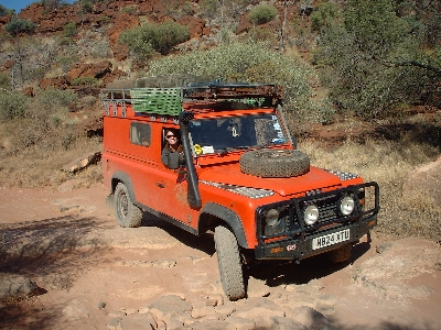
After heading away from the coast, our journey took us towards Karijini National Park. We saw an unusually high number of people changing wheels by the side of the road and over the next couple of days succumbed to both a puncture and a blow-out ourselves (both while Nic was driving!). Not sure what it is about the roads around here, but we met one guy who'd had 4 punctures in one day!
We bush camped our first night next to a billabong just outside of the park and stopped off to drive the very steep 4x4 track to the top of WA's highest mountain - Mount Nameless (right). We took the less lazy option of walking up Mount Bruce (2nd highest) the following day (and yes, there was also a Mount Sheila nearby).
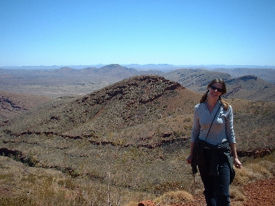
We spent the next couple of days exploring the spectacular gorges in Karijini National Park and went on a mission to reach 'the Junction' where the 4 gorges meet. This involved clambering through the very steep and narrow Hancock Gorge, edging along the smallest of ledges and not looking down. We suspect that it would have been sensible to have had a rope, and have since heard that they often have to rescue people who can't get back!
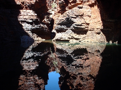
The rest of our time in Karijini was a little more relaxing - swimming at waterfalls and the beautiful Fern Pool (a good excuse for a wash, although disappointing to find out that our suntans were nothing more than a covering of red dust!).
After leaving the park we stopped off at Newman to stock up on supplies and camped in a pleasant spot next to the Gascoyne River. We then drove to Wiluna and the start of the Gunbarrel Highway - life getting hotter and dustier all the time.
We were impressed to find that the permits we'd organised were ready and waiting for us at the Wiluna Shire Office. The Gunbarrel crosses through Aboriginal land so permits are required (nobody ever asks to see them, but they do get you into the Uluru - Kata-Tjuta National Park for free!).
We registered our trip with the Wiluna police station and headed off on the 1396 km remote journey across the outback to the centre.
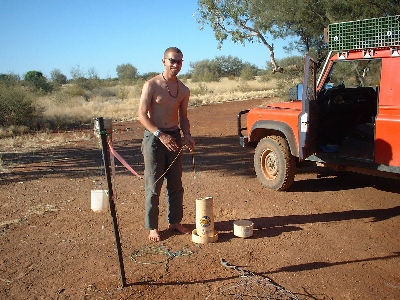
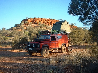
The road started off as a very long, straight dirt track with the occasional well (above), which were invariably empty. We camped our first night in a dry creek, fairly confident that we weren't likely to be washed away at this time of year.
After 348 km we reached Carnegie (population: 3) and stopped off to refuel and have a $5 shower (best $5 ever spent!). This was the first person we'd seen since Wiluna and she seemed surprisingly normal considering.
From here the road became more corrugated and our progress began to slow. We entered into the Gibson Desert Nature Reserve and spent our next night camped next to Mount Beadell (above) - the full moon rose just as the sun was setting. Early in the morning we saw several dingos and disturbed a large group of emus at a watering hole - sending them running in all directions. We waited as gradually, one by one, they returned.
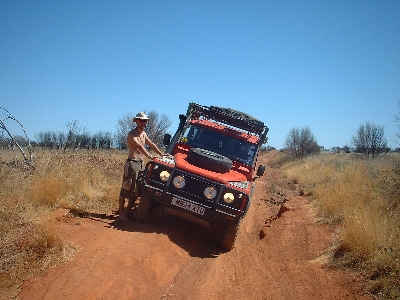
The condition of the road deteriorated over the 488km towards Warburton, with lots of ruts, sand and stone to negotiate - the road here is completely un-maintained..
We stopped off at the Warbutron Roadhouse to re-fuel and figured we must have crossed through a time zone. Nobody seems to have any concept of time out here and when we asked what time it was, "time for what?" was the response. We also noticed that none of these outback stations sell unleaded petrol - apparently the reason for this is because there is a problem with solvent abuse.
The next section of the original Gunbarrel Highway has been abandoned so from here we joined the Central Highway towards Uluru - the track was in much better condition, but still very remote.
The weather was becoming increasingly hot and dry so we weren't surprised to see thick black smoke from bush fires up ahead. We had to be careful selecting our campsite for the night as these fires can travel quickly, but the sunset was a brilliant red (unfortunately not captured on our little digi camera!).
We stopped off at Lasseters Cave where Lasseter (who thought he'd discovered a reef of gold then died trying to find it again) was looked after by aborigines for some weeks. As we were about to enter the cave the wind suddenly picked up and the atmosphere turned wild. We decided perhaps the ancestor spirits were trying to tell us something.
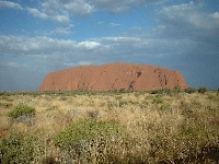
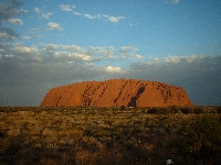

On our final stretch towards Uluru we saw some camels by the side of the road. It was Kata-Tjuta (The Olgas - left) that first came into sight, but we drove on to Uluru (Ayer's Rock) to catch the sunset. Despite the hype and the large large number of people, it was still an impressive sight to watch the world's biggest monolith change from a sandy brown colour to a deep red.
We camped at Yulara, the tourist village which caters for visitors to the park and got up early to watch the sunrise (which wasn't quite as impressive, but there were a lot less people around).
We didn't climb the rock, but took advantage of the fact that it was still early and relatively cool to walk the 10 km around the base. This walk really makes you appreciate the sheer size of it! We rested through the heat of the day and drove back to Kata-Tjuta to walk through the gorge and watch another sunset.
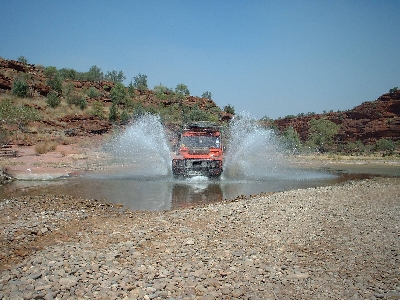
After leaving the area, we followed an unlikely looking track through the Finke Gorge National Park which turned out to be one of the most varied and challenging 4x4 tracks that we'd come across. The track follows the winding river and involves lots of sand, dry river beds and beautiful scenery. There were no other people about, however there was evidence of recent bush fires and the flies are beginning to drive us mad! (right)

As we continued north we found that some parts of the river still had some water (left) - a quiet site called 'Boggy Hole' was abundant with bird life (we didn't splash through that one!).
We took a detour down a very rocky path to Palm Valley (below) - famous for its red cabbage palms which are unique to the area and are evidence of a previously much more tropical climate. We then continued up to Alice Springs where we stayed for a couple of days, resting and trying to sort out a clunking noise under the car that has been happening since China. Turns out that one of the front coil springs is bowing sideways and hitting the chassis.
Our Old Man Emu aftermarket springs are still just about covered under warranty and they have arranged to have some new ones sent up to Darwin for us to save us waiting a week in Alice. Robin has also become the proud owner of a digeridoo.
We travelled west out of Alice through the Macdonnell Ranges (and swam in creek that was so cold you actually couldn't breathe) towards the Tanami track. The Tanami is 1086 km of oppressively boring and very straight dirt tracks, but is a handy cut through to the Kimberley area. The only points of interest for the whole journey were the termite mounds and, towards the end, the impressive Wolfe Creek meteriote crater. By the time we reached Halls Creek the temperature had stepped up a level and was in the forties.